
《ASTER GDEM 第2版数据》(ASTER GDEM v2)[压缩包]
电驴资源
| 用户共享的电驴资源列表 | |
|---|---|
| [ASTER.GDEM.第2版数据].ASTGTM2_N18E108.zip | 4.29 MB |
| [ASTER.GDEM.第2版数据].ASTGTM2_N18E109.zip | 11.59 MB |
| [ASTER.GDEM.第2版数据].ASTGTM2_N18E110.zip | 4.94 MB |
| 20.82 MB | |
电驴资源简介
简介:
转新浪网链接:美卫星拍最详细3D地图 覆盖地球99%大陆
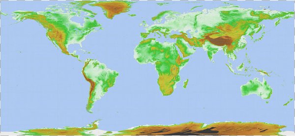
新浪科技讯 北京时间10月26日消息,这是我们这个世界最完整的数字“地形”图,它以3D的形式显示出山脉和其他地貌特征。这些详细的令人难以置信的地图,利用地面设备并不能获得,这些图是由美国宇航局“大地(Terra)”卫星上的可见光/红外照相机拍摄,然后拼接成地球的高低立位(elevation map)图。目前该图已经覆盖地球大陆的99%。
这张名叫“全球数字高程模型(The Global Digital Elevation Model)”的地形图,是利用“大地”卫星搭载的ASTER(日本先进星载热辐射和反射辐射计)收集到的图片合成的。该仪器是美国宇航局的地球观测系统的组成部分,它利用陆地表面的温度、反射比和海拔“绘制”地面的地形图。该相机从可见光和红外光的范围内拍摄图片。这张地形图是用2D图(即已知的立体像对)制成的“3D”图组成的。它的第一个版本于2009年公布,但是现在它已经新增26万个“立体像对”图。
整张图经过不断修改,清晰度得到很大提高,而且水平和垂直方向的准确度也有所增加,目前已经能够识别出直径仅为1公里的水体。华盛顿美国宇航局总部的科学家伍迪-特纳说:“ASTER全球数字高程模型目前已经是世界上最完善、最可靠的全球地形图。”加利福尼亚州帕萨迪纳美国宇航局喷气推进实验室的ASTER科研组负责人麦克-埃布拉姆说:“它的这个更新版为民用用户提供了最清晰的全球地形数据。”ASTER图覆盖地球大陆块的99%,跨度从北纬83度直到南纬83度。该局发出警告说,图里可能偶尔会出现“一些异常”,但它表示,它希望该数据最终能被应用在道路规划等方面。(孝文)
http://tech.sina.com.cn/d/2011-10-26/07276231194.shtml
ASTER User Notification - October 2011
The Ministry of Economy, Trade, and Industry (METI) of Japan and the United States National Aeronautics and Space Administration (NASA) announced the release of the Version 2 ASTER Global Digital Elevation Model (GDEM) on October 17, 2011. The Version 2 release features improved spatial resolution, increased horizontal and vertical accuracy, and superior water body coverage and detection. Version 2 ASTER GDEM data is available to users free of charge from the Land Processes Distributed Active Archive Center (LPDAAC) or Earth Remote Sensing Data Analysis Center (ERSDAC).
Version 2 of the ASTER GDEM is developed, employing an advanced algorithm to improve GDEM resolution and elevation accuracy and reprocessing a total of 1.5 million scene data including additional 250,000 scenes acquired after the previous release. Accuracy of this latest version is validated by the collaborate effort between Japan and the United States, which shows significant improvements over Version 1 (*3). The ASTER GDEM Version 2 will be formally released as an upgrade to Version 1 on October 17, 2011.
Quality Improvements in Version 2
(Example 1) Enhanced ground resolution: The Northern Alps, Japan
The resolution was greatly improved by the new GDEM generation algorithm, from equivalent to about 120m (Version 1) to 70 m (Version 2).
这问题就来了:到底ASTER的空间分辨率是多少?30m还是70m?
Ver.2 Ver.1
Enhanced ground resolution
(Example 2) Reduction of voids: High-latitude areas
Voids observed at high latitudes in Version 1 are removed significantly in Version 2 after addition of 350,000 new scenes
Ver.2 Ver.1
Reduction of voids (black indicates data void)
(Example 3) Flat lake surface: Lake Nicaragua
Lake surface appears completely flat in Version 2 by the new GDEM generation algorithm.
Ver.2 Ver.1
Flat lake surface
(Example 4) Correction of anomalies: Northeastern part of southern Africa
Anomalies caused due to lack of observation data disappeared after addition of 350,000 new scenes.
============================================
以上信息转自磨房@通讯与导航:
http://www.doyouhike.net/forum/comm_nav/545422,0,0,0.html
============================================
转新浪网链接:美卫星拍最详细3D地图 覆盖地球99%大陆
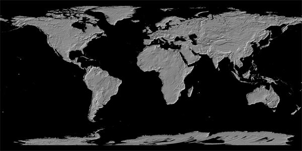
新浪科技讯 北京时间10月26日消息,这是我们这个世界最完整的数字“地形”图,它以3D的形式显示出山脉和其他地貌特征。这些详细的令人难以置信的地图,利用地面设备并不能获得,这些图是由美国宇航局“大地(Terra)”卫星上的可见光/红外照相机拍摄,然后拼接成地球的高低立位(elevation map)图。目前该图已经覆盖地球大陆的99%。
这张名叫“全球数字高程模型(The Global Digital Elevation Model)”的地形图,是利用“大地”卫星搭载的ASTER(日本先进星载热辐射和反射辐射计)收集到的图片合成的。该仪器是美国宇航局的地球观测系统的组成部分,它利用陆地表面的温度、反射比和海拔“绘制”地面的地形图。该相机从可见光和红外光的范围内拍摄图片。这张地形图是用2D图(即已知的立体像对)制成的“3D”图组成的。它的第一个版本于2009年公布,但是现在它已经新增26万个“立体像对”图。
整张图经过不断修改,清晰度得到很大提高,而且水平和垂直方向的准确度也有所增加,目前已经能够识别出直径仅为1公里的水体。华盛顿美国宇航局总部的科学家伍迪-特纳说:“ASTER全球数字高程模型目前已经是世界上最完善、最可靠的全球地形图。”加利福尼亚州帕萨迪纳美国宇航局喷气推进实验室的ASTER科研组负责人麦克-埃布拉姆说:“它的这个更新版为民用用户提供了最清晰的全球地形数据。”ASTER图覆盖地球大陆块的99%,跨度从北纬83度直到南纬83度。该局发出警告说,图里可能偶尔会出现“一些异常”,但它表示,它希望该数据最终能被应用在道路规划等方面。(孝文)
http://tech.sina.com.cn/d/2011-10-26/07276231194.shtml
ASTER User Notification - October 2011
The Ministry of Economy, Trade, and Industry (METI) of Japan and the United States National Aeronautics and Space Administration (NASA) announced the release of the Version 2 ASTER Global Digital Elevation Model (GDEM) on October 17, 2011. The Version 2 release features improved spatial resolution, increased horizontal and vertical accuracy, and superior water body coverage and detection. Version 2 ASTER GDEM data is available to users free of charge from the Land Processes Distributed Active Archive Center (LPDAAC) or Earth Remote Sensing Data Analysis Center (ERSDAC).
Version 2 of the ASTER GDEM is developed, employing an advanced algorithm to improve GDEM resolution and elevation accuracy and reprocessing a total of 1.5 million scene data including additional 250,000 scenes acquired after the previous release. Accuracy of this latest version is validated by the collaborate effort between Japan and the United States, which shows significant improvements over Version 1 (*3). The ASTER GDEM Version 2 will be formally released as an upgrade to Version 1 on October 17, 2011.
Quality Improvements in Version 2
(Example 1) Enhanced ground resolution: The Northern Alps, Japan
The resolution was greatly improved by the new GDEM generation algorithm, from equivalent to about 120m (Version 1) to 70 m (Version 2).
这问题就来了:到底ASTER的空间分辨率是多少?30m还是70m?
Ver.2 Ver.1
Enhanced ground resolution
(Example 2) Reduction of voids: High-latitude areas
Voids observed at high latitudes in Version 1 are removed significantly in Version 2 after addition of 350,000 new scenes
Ver.2 Ver.1
Reduction of voids (black indicates data void)
(Example 3) Flat lake surface: Lake Nicaragua
Lake surface appears completely flat in Version 2 by the new GDEM generation algorithm.
Ver.2 Ver.1
Flat lake surface
(Example 4) Correction of anomalies: Northeastern part of southern Africa
Anomalies caused due to lack of observation data disappeared after addition of 350,000 new scenes.
============================================
以上信息转自磨房@通讯与导航:
http://www.doyouhike.net/forum/comm_nav/545422,0,0,0.html
============================================